
West of the flagship Santa Fe Mine
Exploration project · Nevada, USA
WestSanta Fe
Shallow oxide gold with a growing footprint
Explore the projectOwnershipOption to acquire 100%
Location15 km west of Santa Fe
ObjectiveMaiden resource targeted
Project overview
Near the mine,
distinct opportunity
West Santa Fe is a sediment-hosted epithermal gold and silver system located 15 kilometres west of the Santa Fe Mine.
Recent drilling has returned thick, shallow oxide intercepts from surface. Combined with encouraging cyanide recovery results and a fully permitted drill program, the project provides a second potential resource centre within Lahontan's Nevada portfolio.
Lahontan holds an option to acquire the project outright
Reported in cyanide bottle-roll test work
Reported from the same metallurgical program
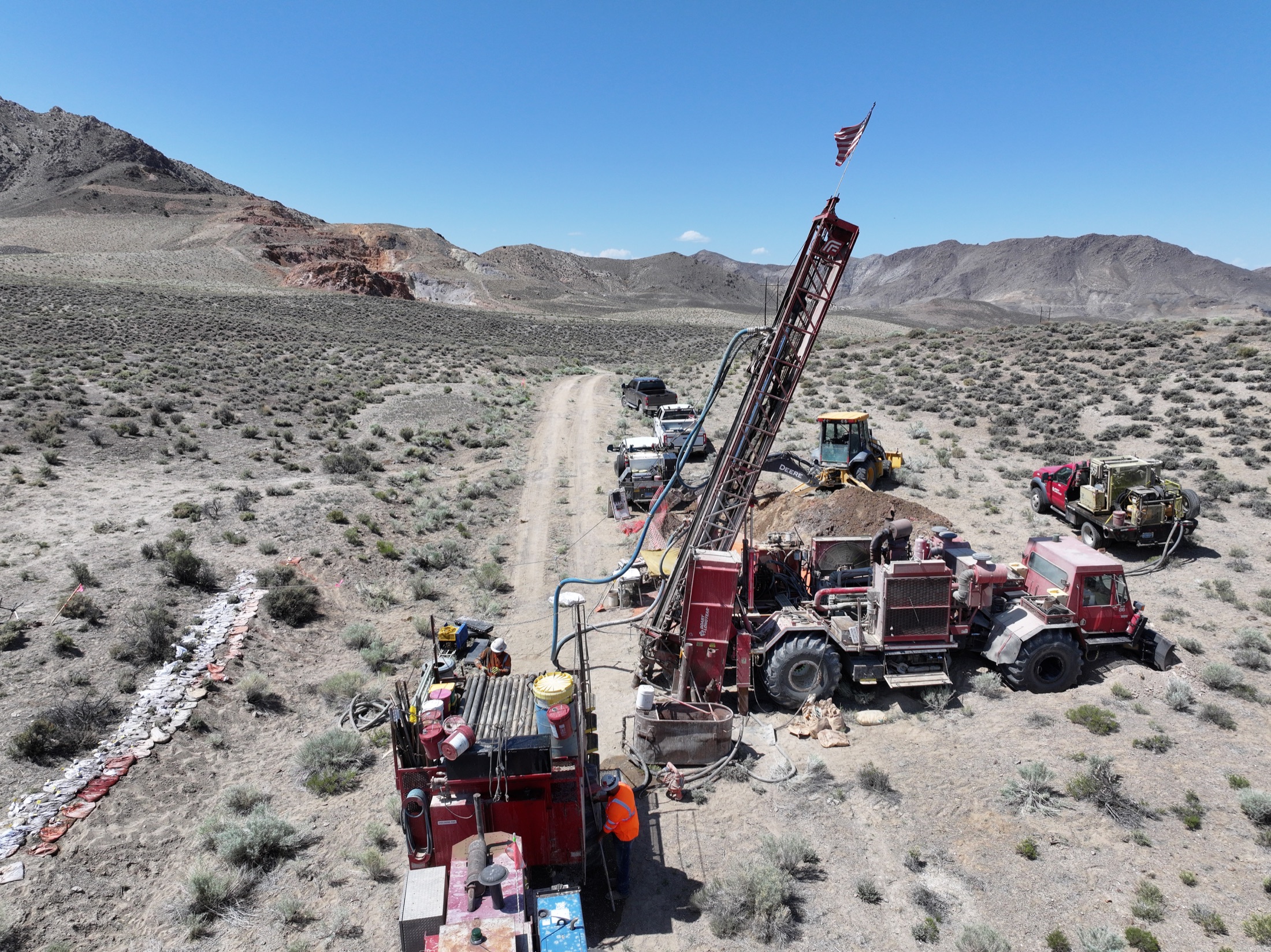
Recent drilling
Thick, shallow,
oxide
Drilling completed across 2025 and 2026 tested near-surface oxide mineralisation and generated a series of broad gold-equivalent intercepts.
grading 3.11 g/t AuEq
including 11 m at 5.75 g/t AuEqgrading 1.00 g/t AuEq
shallow oxide mineralisationgrading 0.83 g/t AuEq
near-surface oxide mineralisationgrading 1.94 g/t AuEq
reported February 2026Intervals shown are drilling highlights reported by the Company and may not represent true widths. See the linked announcements for full results, assumptions and Qualified Person disclosure.
Metallurgy
Oxide material responds to cyanide leaching
cyanide recovery
cyanide recovery
Preliminary bottle-roll testing reported encouraging recoveries for both gold and silver, supporting continued evaluation of the shallow oxide system.
Regional setting
Part of an active Nevada mining district
The project sits within Nevada's Walker Lane, close to the Santa Fe Mine, the Isabella Pearl operation and existing energy infrastructure.
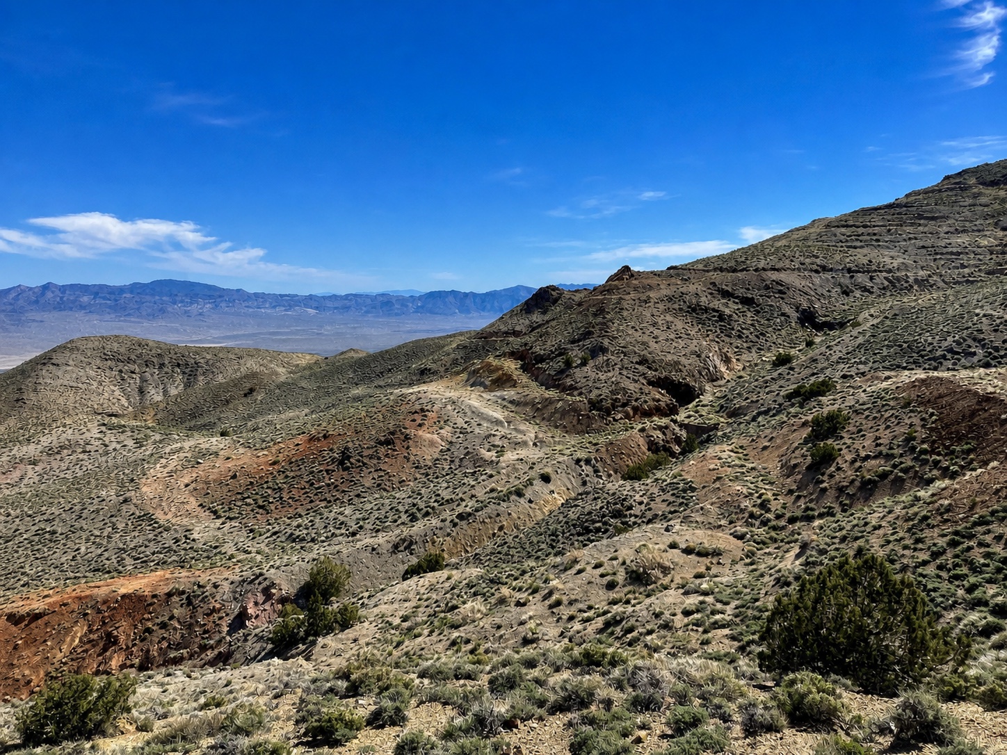
Isabella PearlSanta Fe MineLuning Solar Energy Center
Work program
Building toward a maiden resource
The current exploration strategy is designed to extend known shallow mineralisation, test new targets and assemble the geological and metallurgical data required for a first mineral resource estimate.
- CompleteBLM approval for drilling
- Complete2025–2026 oxide drilling
- CompleteInitial cyanide recovery test work
- Planned3,500 metres of additional drilling
- TargetMaiden Mineral Resource Estimate
Explore the property
Project maps
Regional setting, exploration surveys and drill plans from Lahontan’s published West Santa Fe library. Select a map to open the full-size image in a new tab.
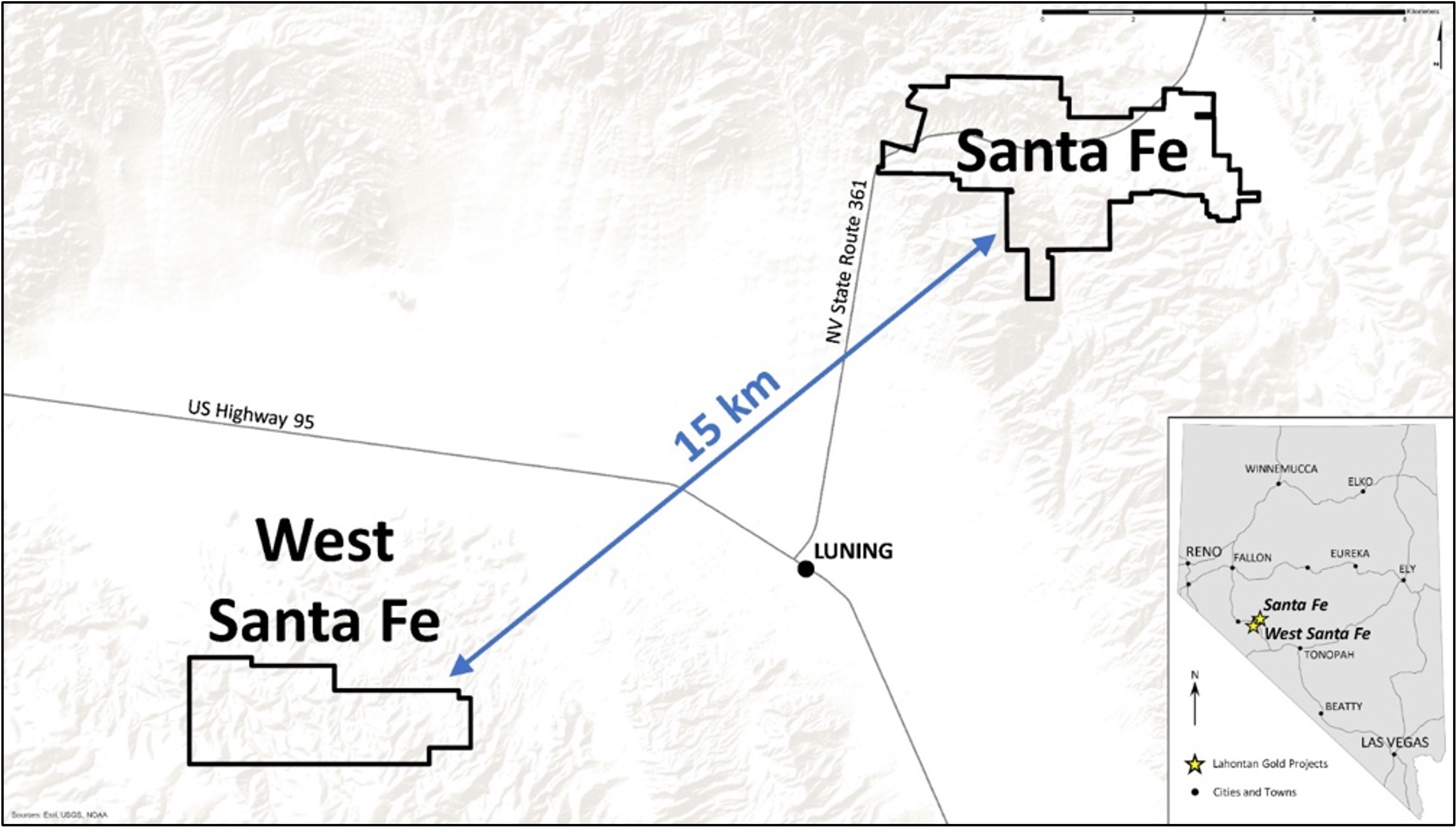
Historical location reference
Regional setting
West Santa Fe’s relationship to the flagship Santa Fe Mine. Property outlines reflect the original map.
View full-size map ↗ (opens in a new tab)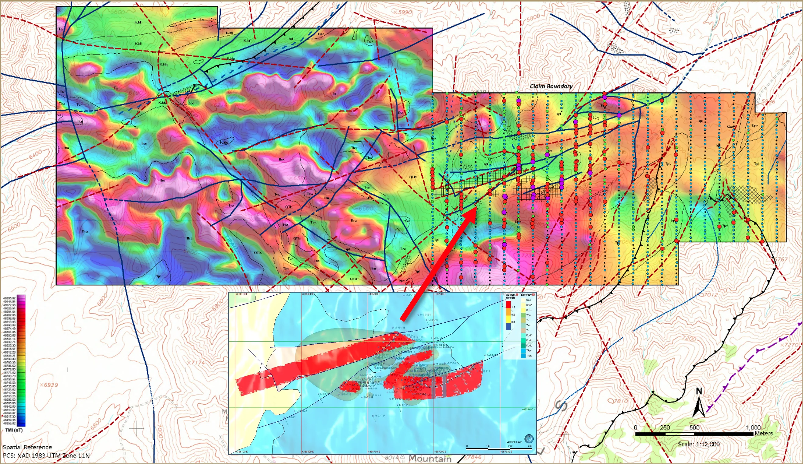
Historical exploration reference
Exploration database
Geophysical and structural context with an inset interpretation based on historical drilling.
View full-size map ↗ (opens in a new tab)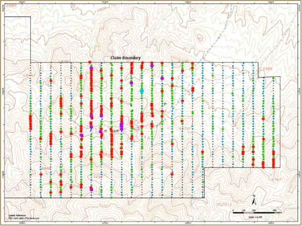
Historical geochemical survey
Silver-in-soil sampling
Published soil-sampling patterns used to identify exploration targets.
View full-size map ↗ (opens in a new tab)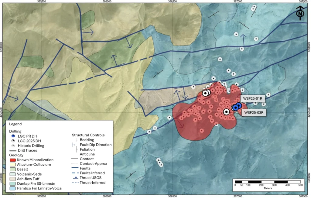
2025 drill program
Drill locations & geology
WSF25-01R and WSF25-03R alongside historical drilling and the mapped mineralized area.
View full-size map ↗ (opens in a new tab)These reference maps retain their original labels and interpretations; historical property outlines are not current boundary surveys. Historical drilling and conceptual mineralization models do not constitute a current mineral resource estimate. Original project library ↗
Stay onthe list
News releases, drill results and permitting milestones, sent as they are filed.