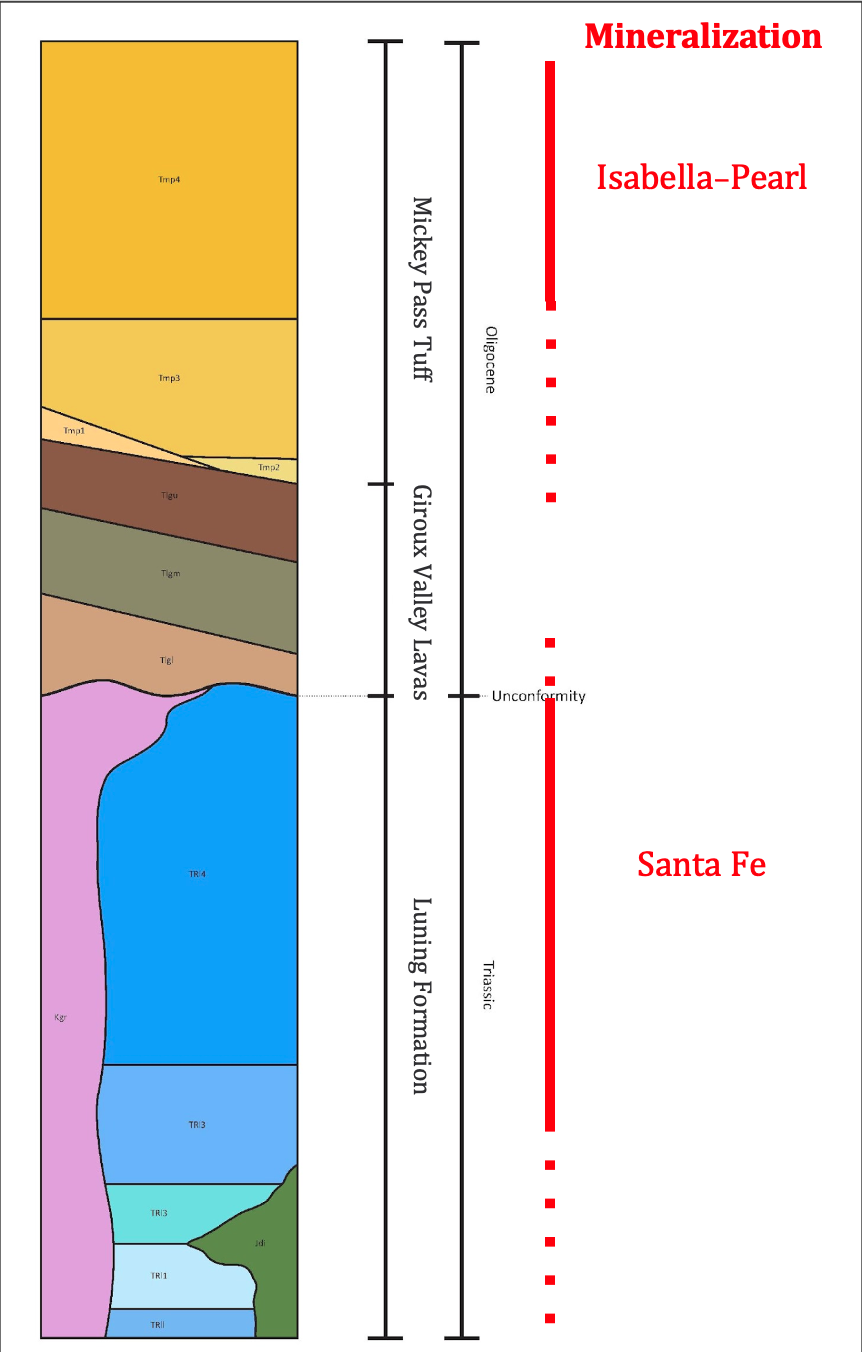
- GEOLOGY
- EXPLORATION TARGETS
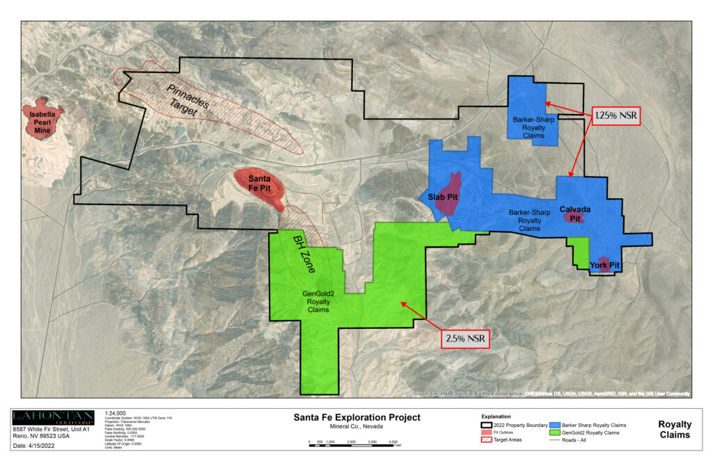
- CLAIM OWNERSHIP
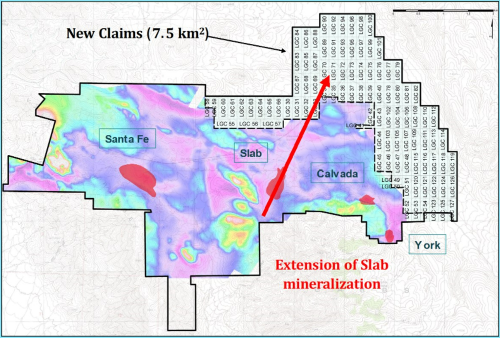
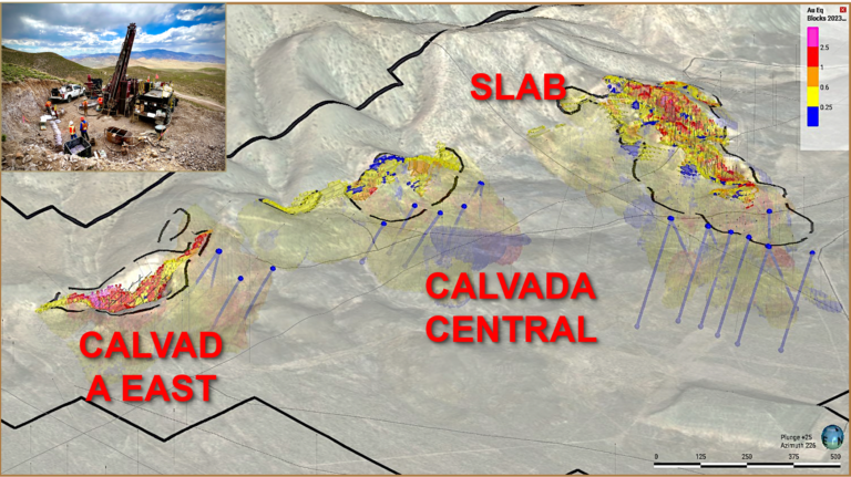
- SLAB-CALVADA AREA
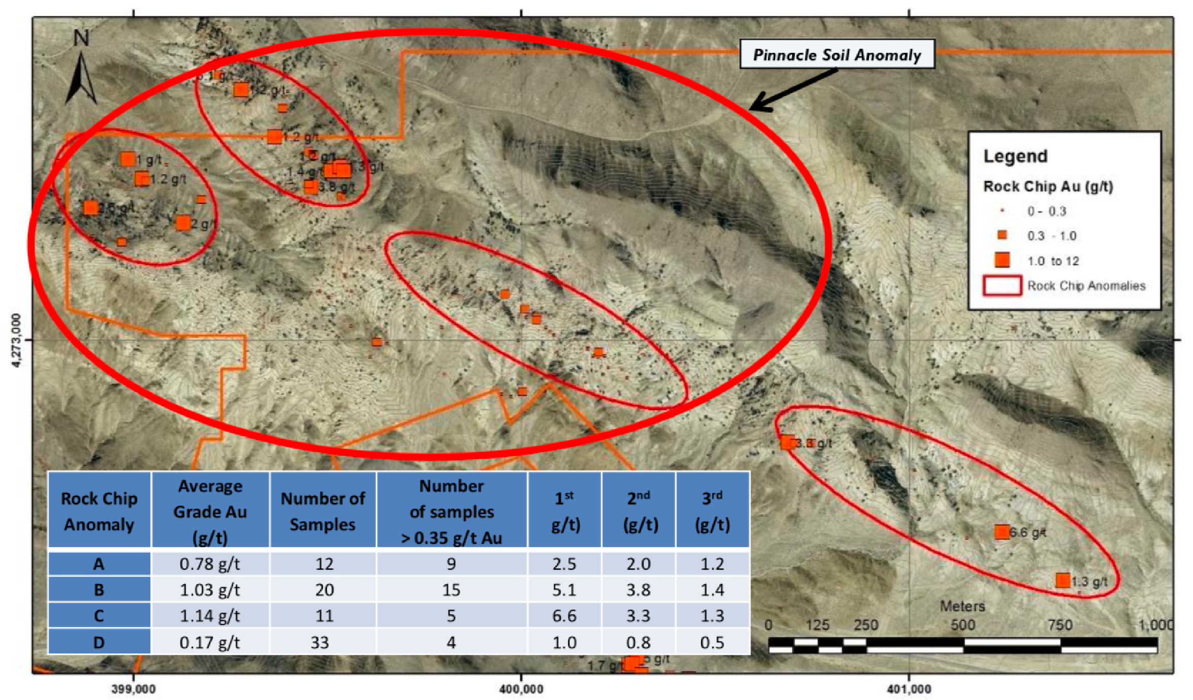
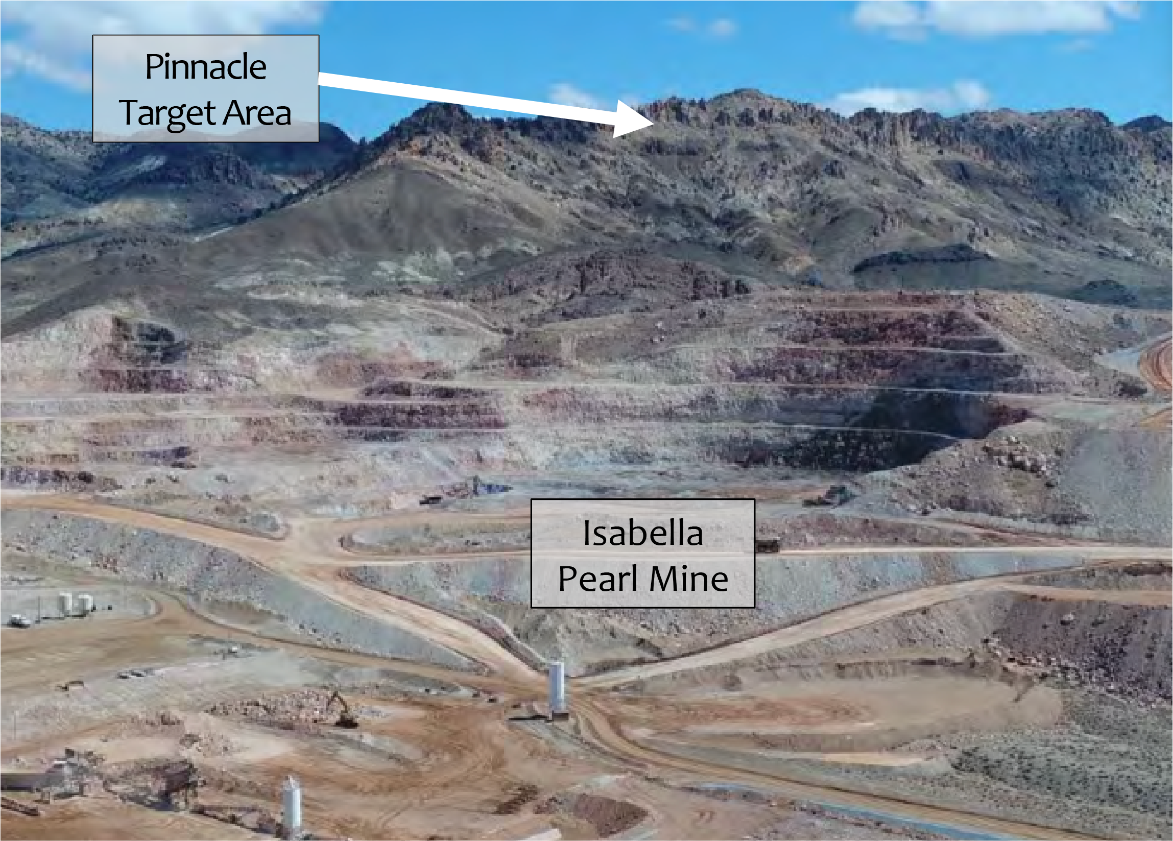
- PINNACLE TARGET AREA
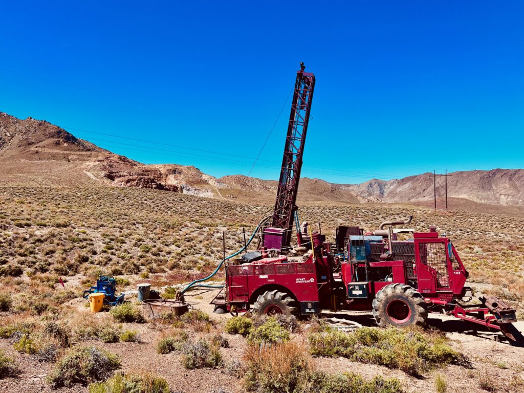
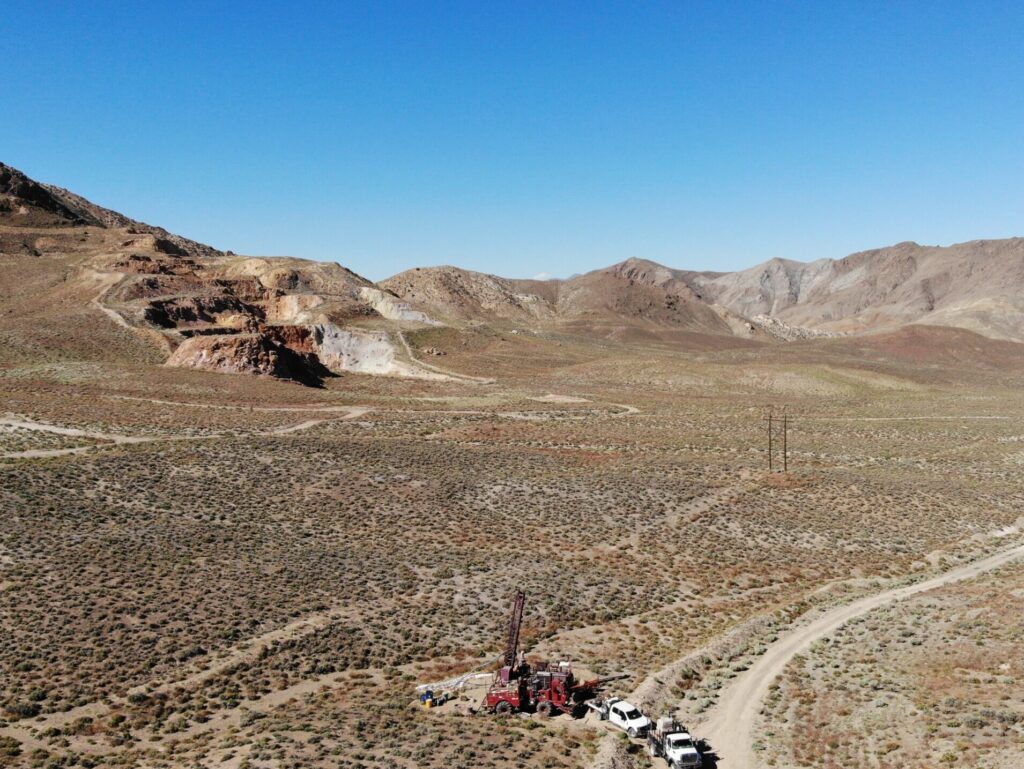
- 2024 DRILLING
- 2025 DRILLING
- 2025 DRILLING PHASE TWO


- Target Area
- Isabella Pearl